Home · Sights · The Bassins à Flot and the Submarine Base
The Bassins à Flot and the Submarine Base
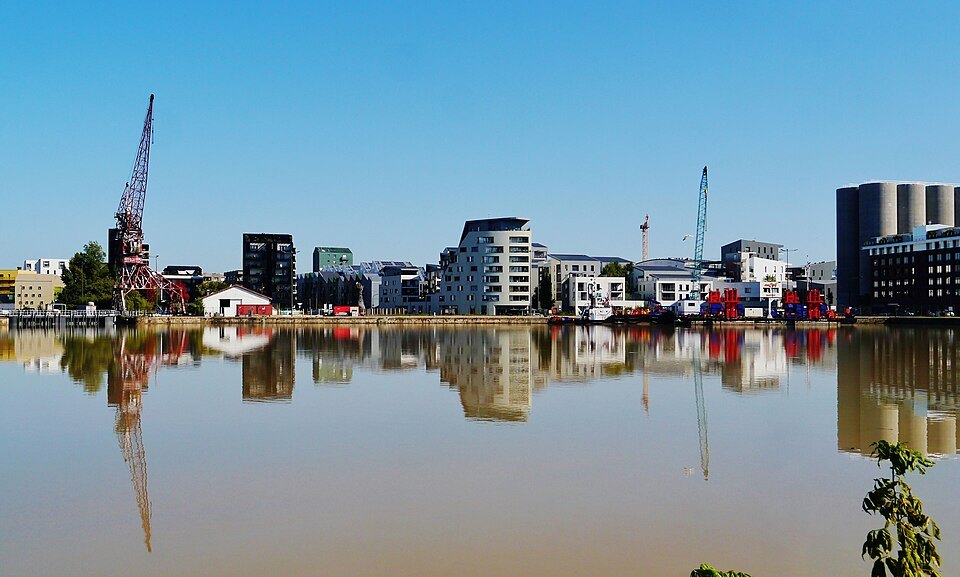
- 01Basin number oneTen hectares of water behind locks, inaugurated in 1879
- 02The Pertuis swing bridgeA pivoting rail bridge between the two basins, opened in 1912
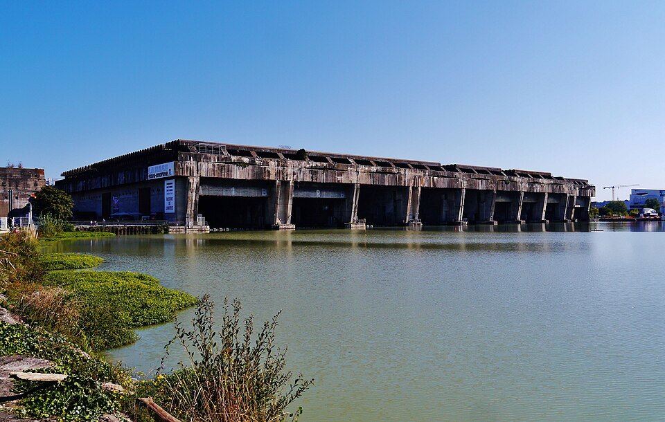
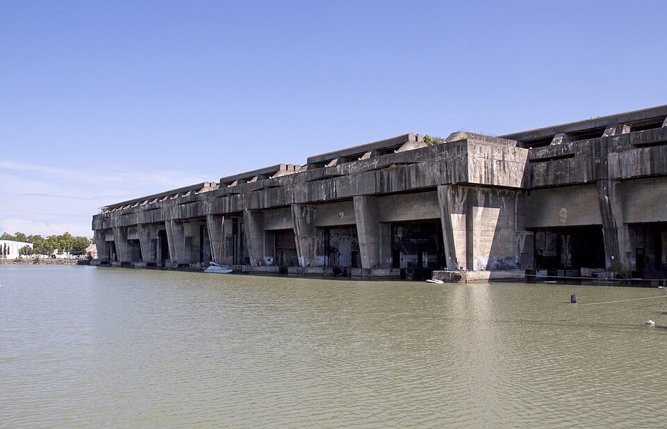
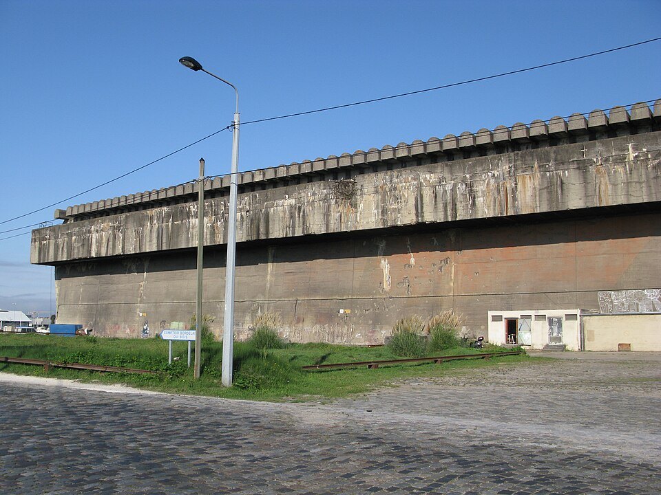
- 03The submarine baseA reinforced concrete block 245 meters long, 162 wide and 20 high
- 04The eleven pensBays 100 to 115 meters long, four of them now flooded with projected art
- 05The Bassins des LumièresA digital art center in the pens since June 2020
- 06The new quarterHousing, offices, a food hall and a maritime museum on the old port land
The story, and how to see it
Why it matters
The Garonne at Bordeaux is tidal, and for a port that is a problem: ships moored at the quays rise and fall with every tide. The answer, at the end of the nineteenth century, was a pair of wet docks, basins closed by locks where the water stays at one level and ships can load and unload in peace. On the eve of the First World War the Bassins à Flot were the busiest part of the port.
They are also where the Second World War left its hardest mark on the city: a vast submarine base, too massive to demolish, that now houses one of the largest digital art centers in the world. Around it, 160 hectares of port wasteland have become a new quarter in little more than a decade, with the Cité du Vin at its river edge.
The story
Drainage of the marshes here began in the sixteenth century under a Flemish engineer, and the district of Bacalan grew up around the port. When the Pont de Pierre was finished in 1822, seagoing ships could no longer reach the upstream quays, and the port needed room downstream. An imperial decree of 1867 launched the first basin; it was inaugurated in 1879, after more than a million cubic meters of earth had been dug out. It covers ten hectares and is fed by artesian wells, with two locks for ships to pass.
Work on the second basin began in 1906, and it opened on 5 November 1912 together with the Pertuis bridge, a swing bridge on rails between the two basins strong enough for goods trains. Railway lines ran along the quays so that cargo passed straight from ship to wagon. Oil mills, sugar refineries, glassworks and warehouses crowded around, much of the business tied to the colonies, and the bars and cabarets of Bacalan served the sailors.
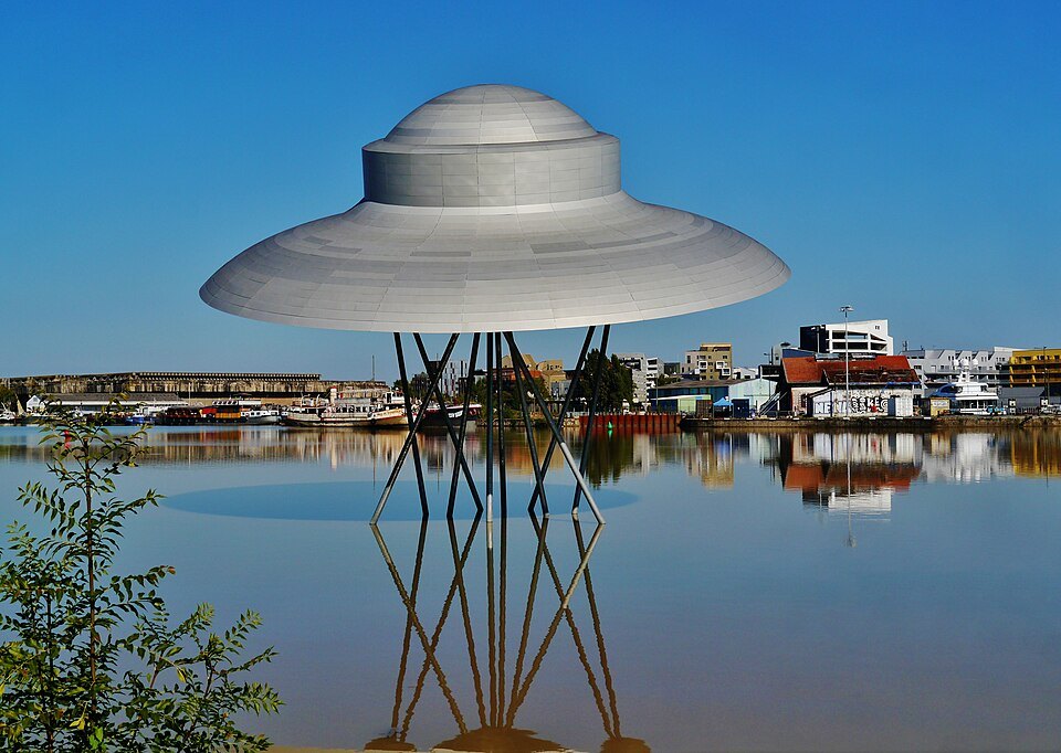
The port kept growing. Two dry docks for repairing ships were dug on the quai du Maroc, the first opening in 1885 and the second finished in 1906, and in 1888 the Bacalan quay was built with four pontoons. A third basin was begun in 1914, and so was a transporter bridge meant to carry traffic across the Garonne without blocking ships; the war stopped it after its two pylons, ninety-five meters high, had already been raised. They stood unfinished over the river until 1942.
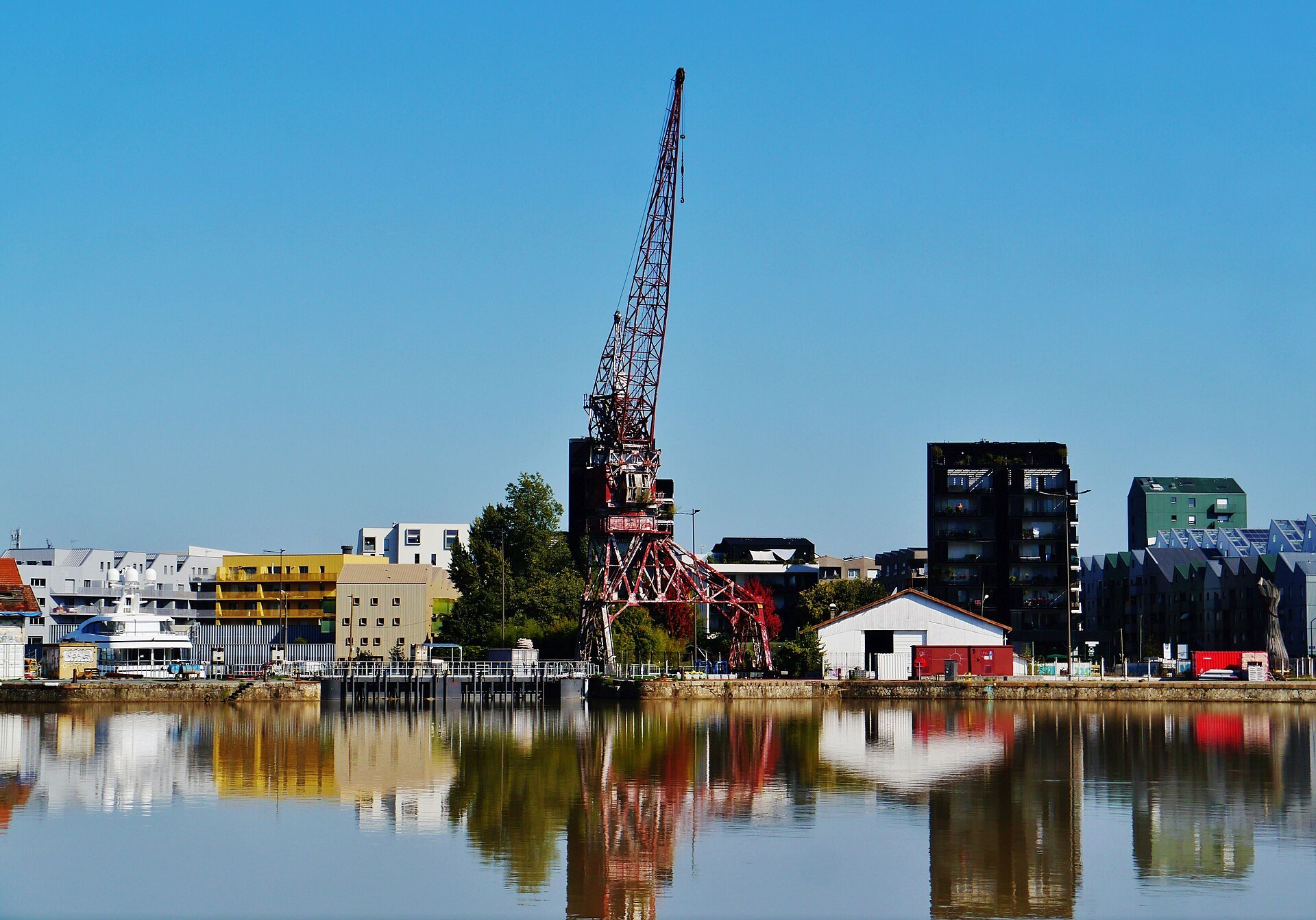
After the war the commercial ships moved away, and for decades the basins were left to themselves. From the 2010s the city turned the area into a new quarter: more than 5,200 homes and new offices went up between 2010 and 2020, along with a food hall and a museum of the sea, while the old docks, cranes and bridge were kept.
The submarine base
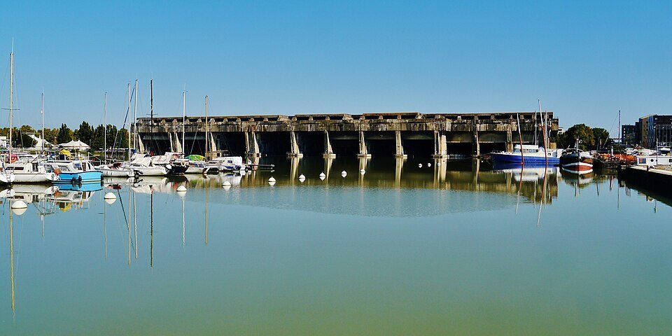
From 1940 the Italian navy based its Atlantic submarines at Bordeaux under the code name Betasom, beta for Bordeaux and som for sommergibili; thirty-two Italian submarines passed through. The German army then had the Todt organization build a bunker on the second basin, starting in September 1941. It took twenty-two months. The result is a block of reinforced concrete 245 meters long, 162 wide and 20 high, with eleven pens of 100 to 115 meters, seven of them wet, and a tower bunker alongside. It sheltered Italian and German submarines until the end of the occupation.
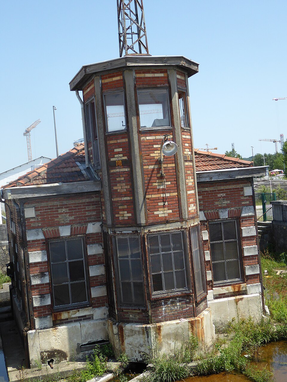
It survived because it was nearly indestructible. The city of Bordeaux owns it, and it has become a cultural venue.
The Bassins des Lumières
Four of the eleven pens, each about 110 meters long, 22 wide and 12 high and still filled with water, were turned into the Bassins des Lumières, a digital art center that opened on 10 June 2020. Ninety projectors and eighty speakers throw images over about 12,000 square meters of concrete walls and dark water, in long immersive programs devoted to painters such as Klimt, Monet and Chagall, or to Venice, with shorter pieces alongside. It bills itself as the largest digital art center in the world, and it drew some 650,000 visitors in 2022.
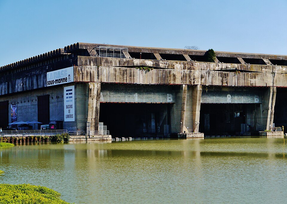
The remaining pens hold other cultural uses, and walking round the outside of the bunker, with its streaked concrete walls rising straight out of the basin, is an experience of its own.
How to visit
The quarter is easy to explore on foot: follow the quay north from the Chartrons, cross the locks and loop round the two basins, which takes about an hour. Tickets for the Bassins des Lumières are sold for set entry times and are best bought ahead at busy periods; see booking ahead. Allow an hour inside.
Tram line B stops at the Cité du Vin, beside the locks, and the river shuttle calls at the Cité du Vin pontoon. The Pont Jacques Chaban-Delmas crosses the river here. The neighborhoods page describes the new quarter as a place to stay.
Honest notes
The Bassins à Flot are a work in progress: new buildings are still going up, and the mix of old port and fresh apartment blocks is not to everyone's taste. The digital shows are popular and polished, but they are projections of paintings, not the paintings themselves.
Nearby
- A short walk awayLa Cité du VinA curving tower of glass and aluminum on the river at the Bassins à Flot.Read the page
- A short walk awayThe Pont Jacques Chaban-DelmasA vertical-lift bridge opened in March 2013 between Bacalan and La Bastide.Read the page
- A short walk awayThe ChartronsThe riverside suburb where English.Read the page