Home · Sights · The Pont de Pierre
The Pont de Pierre
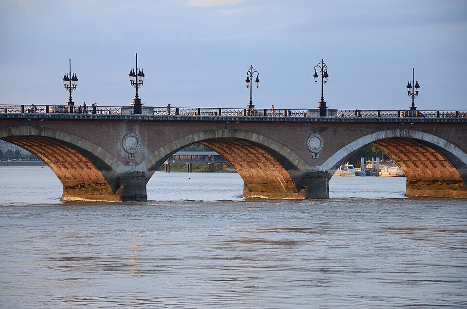
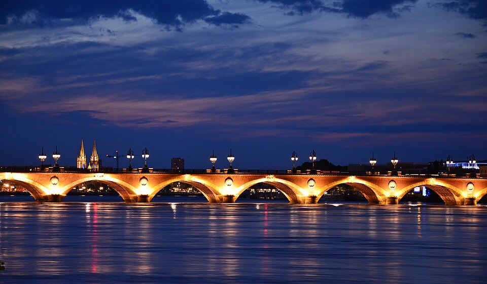
- 01The seventeen archesRed brick vaults on sixteen stone piers, each pier marked with a white medallion
- 02The hollow deckGalleries under the pavements lead to a vaulted chamber above every pier
- 03The piersFounded on some 220 piles of pine driven about ten meters into the riverbed
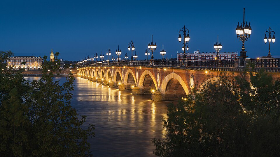
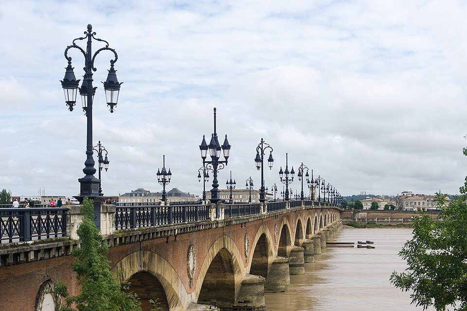
- 04The lampsCast-iron lamp standards along both parapets, redesigned in the 1980s
- 05The viewUpstream to the Saint-Jean bridge, downstream to the whole curve of the quays
The story, and how to see it
Why it matters
For almost two thousand years Bordeaux had no bridge. The Garonne here is wide, fast, tidal and prone to violent floods, and travelers crossed it by ferry. The great engineer Jean-Rodolphe Perronet, founder of the French school of bridge building, thought a bridge at Bordeaux impossible, and when the governor of Guyenne was asked to lay a first stone in the 1770s he said he would rather lay the last one.
The Pont de Pierre changed that, and with it the shape of the city. It joined the old town to the right bank, and in 1865 Bordeaux annexed La Bastide on the far side, where the city and its port could spread. Walking across it is still the best way to see the whole crescent of the Port of the Moon from the water, and at dusk, with its lamps lit, it is the image of Bordeaux that competes with the Place de la Bourse.
The story
Napoleon passed through Bordeaux in April 1808 on his way to Bayonne and was struck by how awkward the crossing was, above all for moving troops toward Spain. A decree of 25 April 1808 listed the works the city needed, a bridge among them. Work began in October 1810 under the engineer Claude Deschamps, first planned in timber on stone piers. It went badly. A flood in December 1813 swept away the scaffolding and the foundations of five piers, and when the Empire fell only six piers stood and the money ran out.
A group of Bordeaux merchants and shipowners led by Pierre Balguerie-Stuttenberg formed the Compagnie du Pont de Bordeaux in 1816 and put up two million francs, in return for the right to charge a toll for ninety-nine years. In 1819 Deschamps proposed a bridge entirely of masonry and promised seventeen arches in three years. He and his son-in-law Jean-Baptiste Billaudel, later mayor of Bordeaux, kept the promise with the help of a diving bell borrowed from the British. About four thousand men worked on it. A mass in the cathedral on 30 April 1822 celebrated the end of the works, a banquet for 150 was laid in the middle of the bridge, and it opened to the public on 1 May 1822.
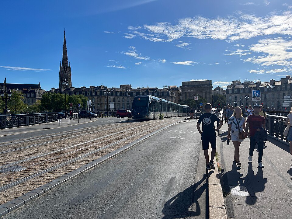
The city bought out the toll in 1863. The bridge was widened in 1954 from under fifteen meters to nineteen, when the two toll pavilions came down, and it remained the only road bridge in Bordeaux until the Pont Saint-Jean opened in 1965.
What you actually see
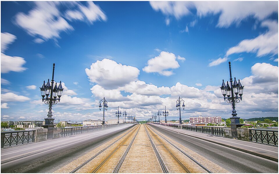
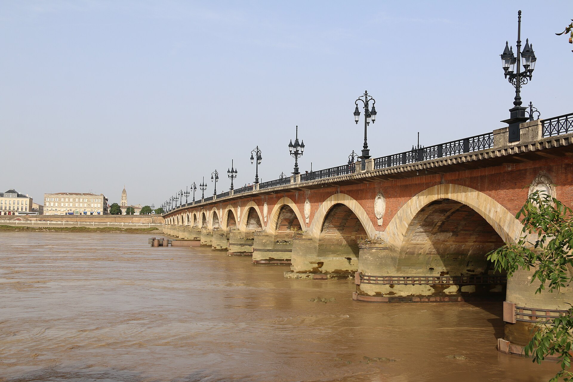
The bridge is 487 meters long, 17 arches on 16 piers, built of stone and brick. Look along the side: each brick pier carries a white medallion that was meant to hold the monogram of Louis XVIII. The facing bricks came from the Dropt valley, the inner bricks were made at La Bastide from Garonne silt, and the stone came from quarries upriver, a stone that hardens on contact with air and water. The deck is hollow, to lighten it, and galleries under the pavements lead to a vaulted chamber above each pier; a fire ran through those galleries in 1921, when they carried water and gas pipes.
Stand in the middle and turn round slowly. Downstream, the quays of the left bank curve away past the Place de la Bourse toward the lift bridge; upstream is the Pont Saint-Jean; behind you the spire of Saint-Michel rises over the roofs; and ahead the right bank of La Bastide, with its gardens along the water. The river moves fast under the arches, and the tide changes its direction and its color through the day.
The bridge today
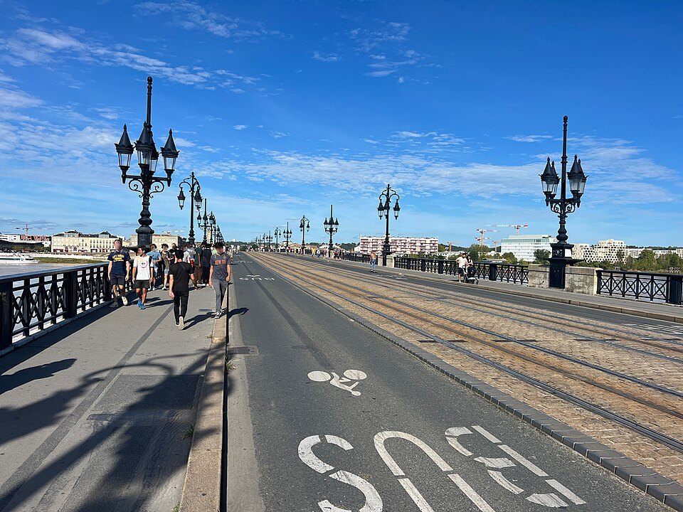
Since 2018 the bridge has been closed to private cars and kept for trams, bicycles and people on foot, with exceptions for buses, taxis and emergency services. Two of its piers settled noticeably in the early 1990s and were reinforced in 1992 and 1993, and the city launched an appeal for donations toward its consolidation in 2017; a full renovation was planned from 2023 over about two years. Expect parts of the deck to be fenced off for works from time to time.
A tram line crosses the bridge, running between the Porte de Bourgogne on the left bank and the Place Stalingrad on the right, so a tram ride across is an easy way to see it too; the lanes were given over to it in 2003.
How to visit
There is nothing to book and no fee. Walk across and back, which takes about twenty minutes without stopping and longer with the views, then follow the right-bank quays downstream for the classic panorama of the city front. The crossing is loveliest early in the morning and at dusk. Come down to the quay at the left end of the bridge for the view of the arches from below.
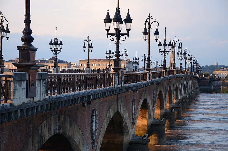
The Porte de Bourgogne, a triumphal gate of the eighteenth century, stands at the city end of the bridge, and the Porte Cailhau is a few minutes downstream.
Honest notes
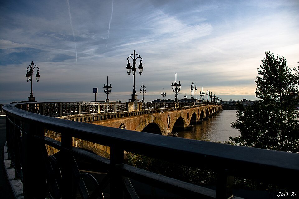
You will hear that the bridge has seventeen arches because Napoléon Bonaparte has seventeen letters. It is a myth: the design had nineteen arches until two were dropped in 1819 for reasons of cost and engineering, after Napoleon had fallen. Another story says a Spanish resistance fighter disarmed German explosives on the bridge in August 1944; he did die near the bridge that day, but historians now think the rescue itself was embellished.
Nearby
- A short walk awayThe Porte Cailhau and Place du ParlementA fortified gate of 1493 to 1496.Read the page
- A short walk awayThe Basilica of Saint-Michel and Its SpireA flamboyant Gothic church of the merchants and craftsmen.Read the page
- A short walk awayPlace de la BourseThe first square in France built open to a river.Read the page